Natural Resources Management and Economic Development
Turning resource potential and infrastructure plans into investable growth
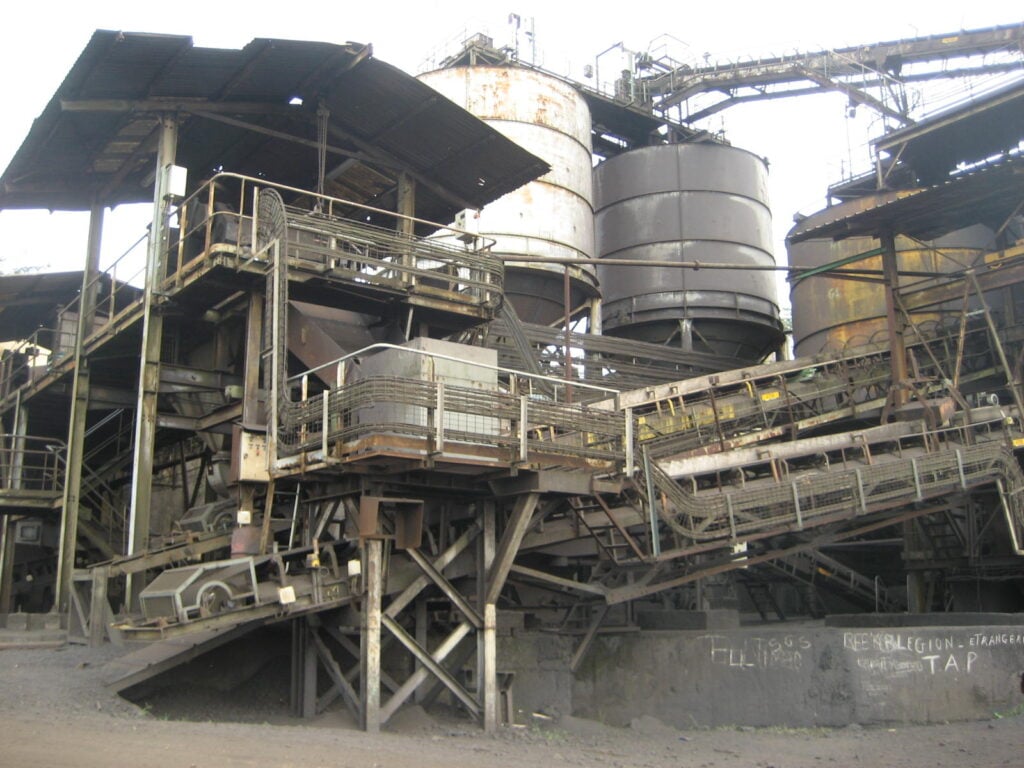
A worker at a mining Development Corridor project in Gabon crosses across a ravine to reach the site using a hand-made jute-rope bridge. Exterior view of a mining operation. (Photo by URC)
Home > Signature Products > Natural Resources Management and Economic Development
Private sector investment is one of the fastest ways to create jobs, raise productivity, and increase public revenues. URC helps governments and investors identify where targeted infrastructure and policy actions can unlock that investment.
With more than 30 years of experience in 50+ countries, we combine local knowledge with global lessons to design practical growth strategies anchored in real assets—resources, people, and infrastructure—so capital can move faster and deliver measurable results.
We support public and private clients—including national governments, development finance institutions, and companies in energy, mining, and other sectors—to make evidence-based investment decisions aligned with long-term economic growth strategy.
Approach
URC delivers two complementary services—growth poles and development corridors—to help clients focus investment where it can scale.
We use a structured planning process that combines spatial analysis with active input from government, investors, and communities. The result is a clear view of where activity can cluster, what shared infrastructure is needed, and which policy actions reduce risk for investors.
Why shared-use planning matters: When infrastructure is built for a single project, countries miss opportunities to diversify and communities see fewer benefits. A development corridor plan designs transport, power, water, and connectivity for multiple users from the start—reducing duplication, improving utilization, and making investments more viable. Clear information on availability and access also helps investors commit capital earlier and spreads up-front costs among multiple entities.
We combine infrastructure, natural resource, and socioeconomic data to map opportunities and constraints using Geographic Information Systems (GIS) and other spatial tools. Findings are strengthened through on-the-ground validation so plans reflect operating conditions, land use, and community priorities.
What we deliver:
Growth poles: We identify places where businesses can cluster around a shared advantage—logistics, power, workforce, proximity to inputs—so companies can lower costs, raise output, and attract suppliers and service providers.
Development corridors: We plan shared transport and energy infrastructure—roads, rail, ports, power, water, and digital connectivity—so multiple industries can use it. This turns a single-project build into a platform for broader investment and job creation.
How It Works
In resource-driven economies, mining often underwrites major infrastructure. Minerals contribute an estimated 6%–7% of global GDP and supply, key inputs for manufacturing and construction. The outlook for minerals remains strong. Demand for copper, lithium, graphite, nickel, and rare earth elements is expected to nearly double by 2040, requiring significant new investment across mining, processing, and enabling infrastructure. This approach turns scattered data and competing priorities into a shared, investable plan—so infrastructure, policy, and private capital reinforce each other instead of moving in isolation.
Outcomes
URC Clients Can Expect:
Examples of Success
Liberia Economic Growth Corridors Study (national strategy and investment sequencing)
URC worked with Liberia’s Ministry of Planning and Economic Affairs to coordinate and sequence post-conflict investments and inform national development strategies. Using GIS and stakeholder engagement, the team produced a national atlas of existing data and identified growth poles and public-private infrastructure investment options for agriculture, mining, energy, transportation, forestry, and services—while flagging environmentally and socially sensitive areas.
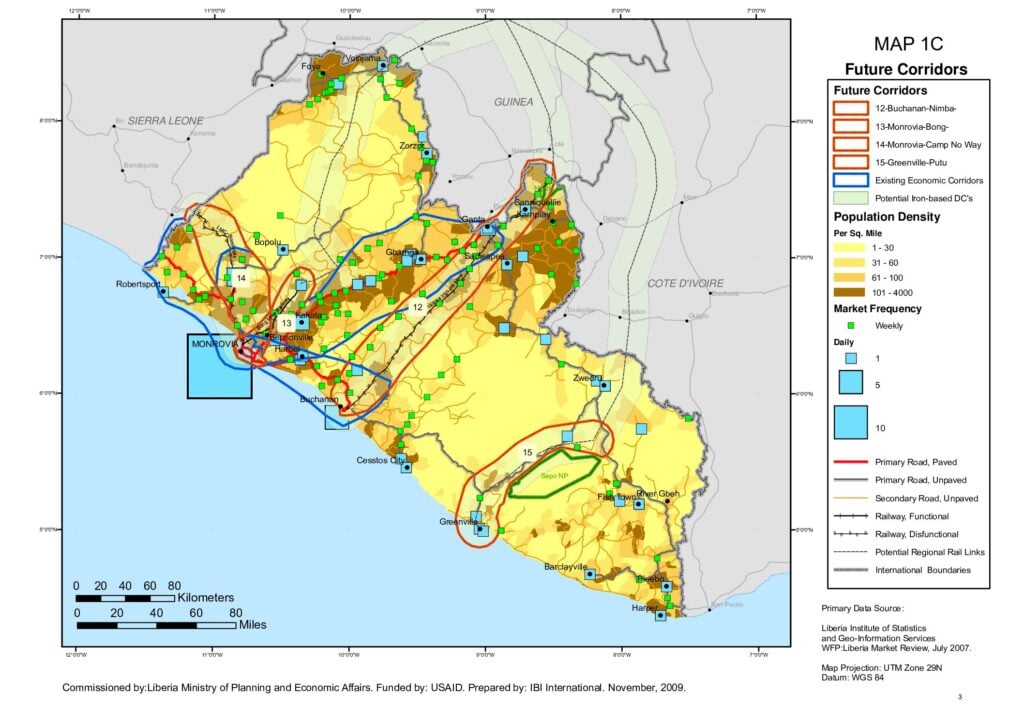
This map shows Development Corridors for Liberia, a part of a larger economic development project URC completed for the country’s Ministry of Planning and Economic Affairs (MPEA). This map includes a Corridor currently under development by Ivanhoe Atlantic, an American mining company.
Map credit:
Liberia Development Corridor Map (2010)
Primary Data Source: Liberia Institute of Statistics and Geo-Information Services
WFP: Liberia Market Review, July 2007
Map Projection: UTM Zone 29N
Datum: WGS 84
Liberia “Liberty Corridor” (anchor investment unlocking shared infrastructure)
The Liberty Corridor shows how an anchor investor can make shared infrastructure financeable. Ivanhoe Atlantic plans to invest about $1.8 billion to develop an iron ore concession near the Guinea border—helping justify transport and logistics upgrades that can also support agriculture, services, and wider regional access.
Gabon Mining Sector Assessment (evidence-based corridor options)
With World Bank support, URC helped Gabon evaluate how mining could fund infrastructure while managing environmental and social risk. Working with the U.S. Geological Survey, the team mapped mineral, socioeconomic, and environmental data to identify high-potential zones, growth poles, and areas where mining, forestry and other land use permits overlapped or conflicted—supporting corridor options that advance economic growth, regional integration, sustainable development, stronger implementation, measurable results, and policy reform.
The analysis delineated high mineral potential for 18 key minerals and supported a mining sector strategy delivered in four volumes (environmental and social strategy, spatial analysis, legal and regulatory review, institutional review). It helped decision-makers compare shared-use rail, port, and power options so infrastructure could serve multiple projects and support broader growth. The Belinga iron ore project is now being developed through a joint venture between Fortescue and the Government of Gabon.